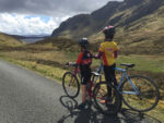
Schiehalion and the Etape Caledonia
Taken from the Blazing Saddles Column in the Tayside Courier Weekend Supplement 5,5.12
Scot Tares looks forward to tomorrow’s Etape Caledonia with three road routes on Schiehallion
“You can say that climbers suffer the same as other riders, but they suffer in a different way. You feel the pain, but you’re glad to be there” – Richard Virenque
Cyclists are a masochistic bunch. Not just content with being the engine to their chosen form of transport, they look to make this harder by seeking out bigger and better climbs to ride up. The Etape Caledonia, taking place tomorrow in Highland Perthshire, is one of the biggest sportive events in the UK and the climb that takes centre stage for this event is that around the slopes of Schiehallion. One of the great reasons to ride on Schiehallion is that it has three different routes of ascent:
The Braes of Foss
This is probably the most popular route on Schiehallion as it is the route used on the Etape Caledonia itself. The steepest section is on the lower reaches of the climb as the road “hairpins” back on itself just past Crossmount Farm. This route also offers the best views of the summit of Schiehallion, visible as you break out from the trees at Lochan an Daim.

| Route: | The climb starts at Lassintullich Farm, winds up past the Braes of Foss and the highest point is at the hikers’ car park. |
| Distance: | 4.16 miles |
| Start: | OS 1:50,000 Map 42 – NN700578 at 678ft |
| Finish: | OS 1:50,000 Map 42 – NN754558 at 1230ft |
| Height Gain: | 552ft at an average of 5.4% for the first section and 2.9% for the second section |
| Climb Category: | 4th Cat Climb |
| Nearest town: | Kinloch Rannoch: OS 1:50,000 Map 42 – NN 684585 |
Tummel Bridge
This is a less well-known route on Schiehallion, but is a favourite of mine. The road here is wider and the surface smoother than on the other ascents and it is also the longest of the three. For spectators of the Etape Caledonia this is a good viewing point to see the riders at the top of the climb and can be accessed on the day via the south of Loch Tummel.
| Route: | Start at Tummel Bridge and cross the river at the power station. A short initial climb levels out before the main ascent which tops out opposite Loch Kinardochy. |
| Distance: | 4.32 miles |
| Start: | OS 1:50,000 Map 42 – NN762592 at 521ft |
| Finish: | OS 1:50,000 Map 42 – NN778545 at 1296ft |
| Height Gain: | 775ft at an average of 5% |
| Climb Category: | 3rd Cat Climb |
| Nearest town: | TummelBridge: OS 1:50,000 Map 42 – NN 763593 |
Glen Goulandie
Many riders don’t get the chance to appreciate the open views and beauty of Glen Goulandie as they hurtle down this side of Schiehallion on the Etape Caledonia; but this is a great way to ascend the mountain.
| Route: | The climb starts at Coshieville and winds up through Glen Goulandie with a few sections where it levels out. |
| Distance: | 3.74 miles |
| Start: | OS 1:50,000 Map 42 – NN777491 at 363ft |
| Finish: | OS 1:50,000 Map 42 – NN775542 at 1211ft |
| Height Gain: | 848ft at an average of 4.2% |
| Climb Category: | 3rd Cat Climb |
| Nearest town: | Aberfeldy: OS 1:50,000 Map 42 – NN 854490 |
Scot Tares
Copyright DC Thompson 2012


